
Padang topographic map
Interactive map
Click on the map to display elevation.
About this map
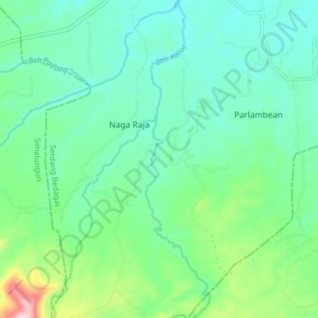
Name: Padang topographic map, elevation, terrain.
Location: Padang, Serdang Bedagai, North Sumatra, Indonesia (3.07274 99.00024 3.14316 99.01352)
Average elevation: 193 m
Minimum elevation: 116 m
Maximum elevation: 446 m
Other topographic maps
Click on a map to view its topography, its elevation and its terrain.
Lake Toba
Lake Toba (Indonesian: Danau Toba, Toba Batak: ᯖᯀᯬ ᯖᯬᯅ; romanized: Tao Toba) is a large natural lake in North Sumatra, Indonesia, occupying the caldera of the Toba supervolcano. The lake is located in the middle of the northern part of the island of Sumatra, with a surface elevation of about 900…
Average elevation: 1,079 m