
Hinesburg topographic map
Interactive map
Click on the map to display elevation.
About this map
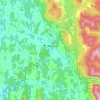
Name: Hinesburg topographic map, elevation, terrain.
Location: Hinesburg, Chittenden County, Vermont, 05461, United States (44.27339 -73.16531 44.37496 -73.01652)
Average elevation: 185 m
Minimum elevation: 63 m
Maximum elevation: 506 m