
Petit mont Sainte-Anne topographic map
Interactive map
Click on the map to display elevation.
About this map
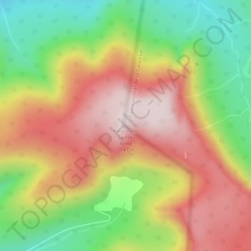
Name: Petit mont Sainte-Anne topographic map, elevation, terrain.
Average elevation: 876 m
Minimum elevation: 597 m
Maximum elevation: 1,142 m
Other topographic maps
Click on a map to view its topography, its elevation and its terrain.
Mont Xalibu
Canada > Québec > Mont-Albert
Mont Xalibu, Mont-Albert, La Haute-Gaspésie, Gaspésie–Îles-de-la-Madeleine, Québec, Canada
Average elevation: 916 m
Lac Victor
Canada > Québec > Mont-Albert
Lac Victor, Mont-Albert, La Haute-Gaspésie, Gaspésie–Îles-de-la-Madeleine, Québec, Canada
Average elevation: 398 m