
Wolfsbach topographic map
Interactive map
Click on the map to display elevation.
About this map
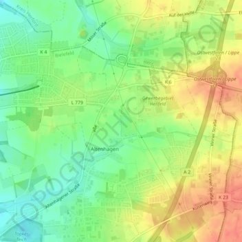
Name: Wolfsbach topographic map, elevation, terrain.
Average elevation: 103 m
Minimum elevation: 79 m
Maximum elevation: 127 m
Other topographic maps
Click on a map to view its topography, its elevation and its terrain.
Lamberg
Deutschland > Nordrhein-Westfalen > Bielefeld
Lamberg, Bielefeld, Nordrhein-Westfalen, 33604, Deutschland
Average elevation: 207 m