Geolocate

Oldman River topographic map

Interactive map

Click on the map to display elevation.

About this map

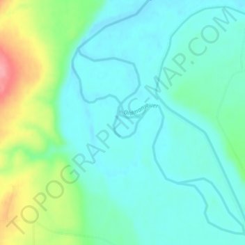
Name: Oldman River topographic map, elevation, terrain.

Location: Oldman River, Alberta, Canada (49.67471 -113.62387 49.67804 -113.61906)

Average elevation: 999 m

Minimum elevation: 972 m

Maximum elevation: 1,077 m

Other topographic maps

Click on a map to view its topography, its elevation and its terrain.

Calgary

Canada > Alberta

Calgary experiences a semi-monsoonal humid continental climate (Köppen climate classification Dwb) within eastern parts of the city and a subarctic climate (Köppen climate classification Dwc) within western parts of the city due to an increase in elevation. The city has warm, comfortable summers and…

Average elevation: 1,106 m

Edmonton

Canada > Alberta

Edmonton is on the North Saskatchewan River, at an elevation of 671 m (2,201 ft). It is North America's northernmost city with a metropolitan population over one million. It is at the same latitude as Hamburg (Germany); Dublin (Ireland); Manchester (United Kingdom); and Magnitogorsk (Russia). It is south of…

Average elevation: 690 m

Banff

Canada > Alberta > Banff > Banff

Banff is a town within Banff National Park in Alberta, Canada. It is located in Alberta's Rockies along the Trans-Canada Highway, approximately 126 km (78 mi) west of Calgary and 58 km (36 mi) east of Lake Louise. At 1,400 to 1,630 m (4,590 to 5,350 ft) above sea level, Banff is the community with the second…

Average elevation: 1,615 m

Grande Prairie

Canada > Alberta > Grande Prairie

Grande Prairie is located just north of the 55th parallel north, and is 465 km (289 mi) northwest of Edmonton, lying at an elevation of 669 m (2,195 ft) above sea level. The city is surrounded by farmland to the north, east, and west. To the south lies a vast boreal forest with aspen, tamarack, lodgepole pine,…

Average elevation: 668 m

Crowsnest Pass

Canada > Alberta > Crowsnest Pass

Average elevation: 1,410 m

Calgary

Canada > Alberta > Calgary

Average elevation: 1,106 m

Fort McMurray

Canada > Alberta > Wood Buffalo

The community lies at a lower elevation than most other parts of Alberta, so under the right conditions it can be a "hot spot" for Alberta.

Average elevation: 345 m

Red Deer

Canada > Alberta > Red Deer

Average elevation: 918 m

St. Albert

Canada > Alberta > St. Albert

Average elevation: 681 m

Canmore

Canada > Alberta > Town of Canmore

Elevation Place opened in April 2013 as Canmore's new recreation facility. Construction of the facility began in 2012 to replace the Canmore Recreation Centre (the community's old facility). The facility offers an 8-lane 25m lap pool, a world class climbing wall developed by Walltopia, two cardio rooms, a…

Average elevation: 1,565 m

Lake Louise

Canada > Alberta > Improvement District No. 9

Lake Louise is a hamlet within Banff National Park in Alberta, Canada. Named after Princess Louise, Duchess of Argyll, it lies in Alberta's Rockies on the Bow River, 3 km (1.9 mi) northeast of the lake that shares its name. Initially settled in 1884 as an outpost for the Canadian Pacific Railway, Lake Louise…

Average elevation: 1,617 m

Chambers Creek

Canada > Alberta > Clearwater County

Average elevation: 1,050 m

Medicine Hat

Canada > Alberta

Average elevation: 708 m

Lethbridge

Canada > Alberta > Lethbridge

Its high elevation of 929 m (3,047.9 ft) and close proximity to the Rocky Mountains provides Lethbridge with cooler summers than other locations in the Canadian Prairies. These factors protect the city from strong northwest and southwest winds and contribute to frequent chinook winds during the winter.…

Average elevation: 918 m

Waterton Lakes National Park

Canada > Alberta > Improvement District No. 04

Operated by Parks Canada, Waterton is open all year, but the main tourist season is during July and August. The only commercial facilities available within the park are located at the Waterton Park townsite. This park ranges in elevation from 1,290 metres (4,232 ft) at the townsite to 2,910 m (9,547 ft) at…

Average elevation: 1,778 m

Cochrane

Canada > Alberta > Town of Cochrane > Cochrane

Cochrane is situated at the base of Big Hill in the Bow River Valley. It sits at an elevation of 1,186 m (3,891 ft). The town is intersected by Highway 1A and Highway 22. Cochrane has a reputation for its western culture, which can easily be felt when one wanders the streets (particularly Main Street). The…

Average elevation: 1,205 m

Cline River

Canada > Alberta > Clearwater County

Average elevation: 2,171 m

Municipality of Jasper

Canada > Alberta

Average elevation: 1,789 m

Town of Canmore

Canada > Alberta

Average elevation: 1,813 m

Edmonton

Canada > Alberta > Edmonton

Average elevation: 677 m

Sherwood Park

Canada > Alberta > Strathcona County

Average elevation: 691 m

Rimbey

Canada > Alberta

Average elevation: 913 m

Foothills County

Canada > Alberta

Average elevation: 1,196 m

Jasper National Park

Canada > Alberta

Average elevation: 1,782 m

Keswick

Canada > Alberta > Edmonton

Average elevation: 676 m

Keswick

Canada > Alberta > Edmonton

Average elevation: 676 m

Glengarry

Canada > Alberta > Edmonton

Average elevation: 673 m

Okotoks

Canada > Alberta > Town of Okotoks

Average elevation: 1,096 m

Town of Barrhead

Canada > Alberta

The area contains dense stands of spruce, birch, pine and poplar. It also has some of the most fertile farmland in the province and is located between two major rivers, the Athabasca River and Pembina River. The Paddle River, a tributary of the Pembina River, flows directly through the town Barrhead. If you go…

Average elevation: 652 m

Airdrie

Canada > Alberta > Airdrie

Average elevation: 1,112 m

Steveville

Canada > Alberta > Special Area No. 2

Average elevation: 659 m

Bow River

Canada > Alberta > Canmore

Average elevation: 1,353 m

Municipal District of Taber

Canada > Alberta

Average elevation: 816 m

Claresholm

Canada > Alberta > Town of Claresholm

Average elevation: 1,031 m

Hawks Ridge

Canada > Alberta > Edmonton

Average elevation: 670 m

Shaughnessy

Canada > Alberta > Lethbridge County

Average elevation: 907 m

Pyramid Mountain

Canada > Alberta > Municipality of Jasper

Average elevation: 2,152 m

Maligne Lake

Canada > Alberta > Improvement District No. 12

Wildlife is surprisingly abundant along this high altitude oligotrophic lake. Grizzly bear, black bear, mule deer, caribou, wolves, moose, and mountain sheep are some of the larger mammals that frequent the lake area during the summer season. Bald eagles, golden eagles and osprey also frequent the area and…

Average elevation: 2,125 m

Beaverlodge

Canada > Alberta > Town of Beaverlodge

Average elevation: 735 m

Bassano

Canada > Alberta > Town of Bassano

Average elevation: 798 m

Cochrane Lake

Canada > Alberta > Rocky View County

Average elevation: 1,292 m

Lake Louise

Canada > Alberta > Improvement District No. 9

Lake Louise is a hamlet within Banff National Park in Alberta, Canada. Named after Princess Louise, Duchess of Argyll, it lies in Alberta's Rockies on the Bow River, 3 km (1.9 mi) northeast of the lake that shares its name. Initially settled in 1884 as an outpost for the Canadian Pacific Railway, Lake Louise…

Average elevation: 1,617 m

William A. Switzer Provincial Park

Canada > Alberta > Yellowhead County

This park is situated within the foothills of Alberta's Rocky Mountains, at an elevation of 1,150 m (3,770 ft) to 1,300 m (4,300 ft) and has a surface of 93 km2 (36 sq mi). It was established on December 22, 1958 and is maintained by Alberta Tourism, Parks and Recreation. The park is named after former…

Average elevation: 1,348 m

Hector Lake

Canada > Alberta > Improvement District No. 9

Average elevation: 1,925 m

Jasper Park

Canada > Alberta > Edmonton

Average elevation: 672 m

Bear Canyon

Canada > Alberta > Clear Hills County

Average elevation: 638 m

Town of Hinton

Canada > Alberta

Average elevation: 1,088 m

Osprey Hill

Canada > Alberta > Calgary

Average elevation: 1,183 m

Hardisty

Canada > Alberta > Town of Hardisty

Average elevation: 639 m

Crowsnest Pass

Canada > Alberta

Average elevation: 1,512 m

Hodgson

Canada > Alberta > Edmonton

Average elevation: 677 m

Cherhill

Canada > Alberta > Lac Ste. Anne County

Average elevation: 727 m

Calgary

Canada > Alberta

Average elevation: 1,104 m

Calgary

Canada > Alberta

Average elevation: 1,104 m

Foothills County

Canada > Alberta

Average elevation: 1,196 m

Morinville

Canada > Alberta

Average elevation: 702 m

Bow Peak

Canada > Alberta > Improvement District No. 9

Bow Peak is a 2,840-metre (9,320-foot) mountain summit located in the Bow River valley of Banff National Park, in the Canadian Rockies of Alberta, Canada. Its nearest higher peak is Crowfoot Mountain, 2.11 km (1.31 mi) to the east. Bow Peak is situated north of Hector Lake, southeast of Bow Lake, and can be…

Average elevation: 2,332 m

Strathmore

Canada > Alberta

Average elevation: 973 m

Village of Lomond

Canada > Alberta > Vulcan County

Average elevation: 874 m

Discovery Ridge

Canada > Alberta > Calgary

Average elevation: 1,127 m

Okotoks

Canada > Alberta > Town of Okotoks

Average elevation: 1,096 m

Redstone

Canada > Alberta > Calgary

Average elevation: 1,095 m

Empress

Canada > Alberta

It is located on the southern bank above the Red Deer River, 9 km (5.6 mi) northwest of the confluence of Red Deer River and South Saskatchewan River, at an elevation of 650 metres (2,130 ft). It is connected to Buffalo Trail by Highway 899 and Highway 562.

Average elevation: 603 m

Stony Plain

Canada > Alberta

Average elevation: 711 m

Carstairs

Canada > Alberta

Average elevation: 1,054 m

Village of Warner

Canada > Alberta

Average elevation: 1,016 m

Banff

Canada > Alberta

Average elevation: 1,423 m

Drumheller

Canada > Alberta > Drumheller

Average elevation: 763 m

Meanook

Canada > Alberta > Athabasca County

Average elevation: 623 m

Red Deer Junction

Canada > Alberta > Red Deer County

Average elevation: 862 m

Kananaskis Improvement District

Canada > Alberta

Average elevation: 1,741 m

Webster

Canada > Alberta > County of Grande Prairie

Average elevation: 805 m

Hamlet of Monarch

Canada > Alberta > Lethbridge County

Average elevation: 933 m

Strathcona County

Canada > Alberta

Average elevation: 691 m

Acadia

Canada > Alberta > Calgary

Average elevation: 1,049 m

Town of Cardston

Canada > Alberta

Average elevation: 1,166 m

Chigwell

Canada > Alberta > Lacombe County

Average elevation: 881 m

Cold Lake

Canada > Alberta > Cold Lake

Average elevation: 550 m

Camrose

Canada > Alberta

Average elevation: 746 m

Tunnel Mountain

Canada > Alberta > Improvement District No. 9

Although only 5500 feet in altitude above sea level, the summit is a magnificent viewpoint, covering the Bow River valley both east and west. The chief advantage is that, set at a position ... midway between the valley bottom and the crests of the encircling mountain ranges, it does full value in perspective…

Average elevation: 1,423 m

City of Lloydminster

Canada > Alberta

Average elevation: 650 m

Suffield

Canada > Alberta > Cypress County

Average elevation: 747 m

Waterton Park

Canada > Alberta > Improvement District No. 04

It is located at the southwestern terminus of Highway 5, approximately 54 kilometres (34 mi) west of the Town of Cardston and 55 kilometres (34 mi) south of the Town of Pincher Creek. This hamlet is north of Glacier National Park in Montana. It has an elevation of 1,280 metres (4,200 ft).

Average elevation: 1,456 m

Mount Forbes

Canada > Alberta > Improvement District No. 9

Average elevation: 2,835 m

Special Area No. 3

Canada > Alberta

Average elevation: 744 m

Town of Fox Creek

Canada > Alberta

Fox Creek is a town in northwest Alberta, Canada. It is located on Highway 43, approximately 259 km (161 mi) northwest of Edmonton and 199 km (124 mi) southeast of Grande Prairie, and has an elevation of 808 m (2,651 ft).

Average elevation: 824 m