
West Sumatra topographic map
Interactive map
Click on the map to display elevation.
About this map
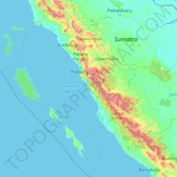
Name: West Sumatra topographic map, elevation, terrain.
Location: West Sumatra, Indonesia (-3.58446 98.23640 0.90739 101.88612)
Average elevation: 161 m
Minimum elevation: -2 m
Maximum elevation: 3,657 m