
Арзамас topographic map
Interactive map
Click on the map to display elevation.
About this map
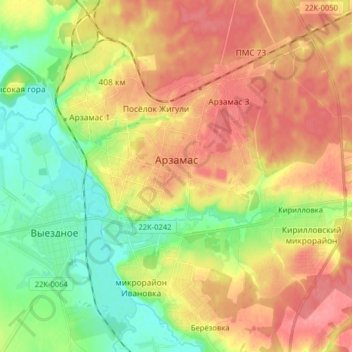
Name: Арзамас topographic map, elevation, terrain.
Average elevation: 149 m
Minimum elevation: 114 m
Maximum elevation: 182 m
Other topographic maps
Click on a map to view its topography, its elevation and its terrain.
Парк культуры и отдыха им. А. П. Гайдара
Россия > Нижегородская область > городской округ Арзамас > Арзамас
Average elevation: 156 m