
Stavropol Krai topographic map
Interactive map
Click on the map to display elevation.
About this map
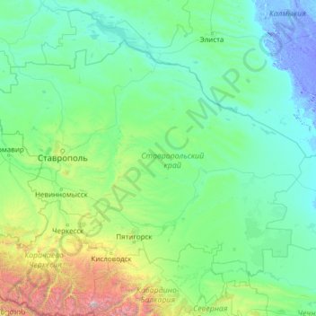
Name: Stavropol Krai topographic map, elevation, terrain.
Location: Stavropol Krai, North Caucasian Federal District, Russia (43.65843 40.84604 46.23652 45.71595)
Average elevation: 343 m
Minimum elevation: -19 m
Maximum elevation: 5,603 m
Other topographic maps
Click on a map to view its topography, its elevation and its terrain.
Pyatigorsk
Russia > Stavropol Krai > Pyatigorsk
Pyatigorsk, Stavropol Krai, North Caucasian Federal District, Russia
Average elevation: 578 m