
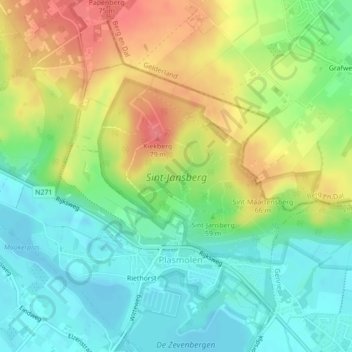
Sint-Jansberg topographic map
Interactive map
Click on the map to display elevation.
About this map
Name: Sint-Jansberg topographic map, elevation, terrain.
Average elevation: 35 m
Minimum elevation: 6 m
Maximum elevation: 76 m
Other topographic maps
Click on a map to view its topography, its elevation and its terrain.
Kiekberg
Nederland > Limburg > Mook en Middelaar
Kiekberg, Mook en Middelaar, Limburg, Nederland, 6586AN, Nederland
Average elevation: 40 m