
Ohrid topographic map
Interactive map
Click on the map to display elevation.
About this map
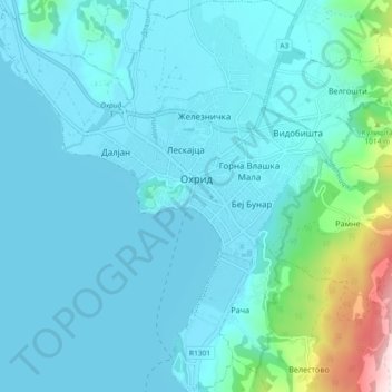
Name: Ohrid topographic map, elevation, terrain.
Location: Ohrid, Municipality of Ohrid, Southwestern Region, Macedonia (41.07930 20.75443 41.14863 20.83036)
Average elevation: 773 m
Minimum elevation: 686 m
Maximum elevation: 1,459 m