
Mers El Kebir topographic map
Interactive map
Click on the map to display elevation.
About this map
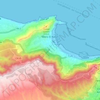
Name: Mers El Kebir topographic map, elevation, terrain.
Location: Mers El Kebir, Daïra Aïn Turk, Oran, 31014, Algérie (35.69777 -0.74189 35.73949 -0.65794)
Average elevation: 180 m
Minimum elevation: -2 m
Maximum elevation: 513 m
Other topographic maps
Click on a map to view its topography, its elevation and its terrain.
Aïn El Turk
Algérie > Oran > Daïra Aïn Turk
Aïn El Turk, Daïra Aïn Turk, Oran, Algérie
Average elevation: 117 m