
Houtaing topographic map
Interactive map
Click on the map to display elevation.
About this map
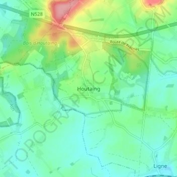
Name: Houtaing topographic map, elevation, terrain.
Location: Houtaing, Ath, Hainaut, Wallonie, 7903, Belgique (50.61975 3.65998 50.65975 3.69998)
Average elevation: 62 m
Minimum elevation: 34 m
Maximum elevation: 138 m