
Osterode topographic map
Interactive map
Click on the map to display elevation.
About this map
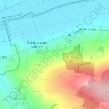
Name: Osterode topographic map, elevation, terrain.
Average elevation: 141 m
Minimum elevation: 83 m
Maximum elevation: 278 m
Other topographic maps
Click on a map to view its topography, its elevation and its terrain.
Hoppenstedt
Deutschland > Sachsen-Anhalt > Landkreis Harz > Osterwieck
Hoppenstedt, Osterwieck, Landkreis Harz, Sachsen-Anhalt, 38835, Deutschland
Average elevation: 128 m
Rhoden
Deutschland > Sachsen-Anhalt > Landkreis Harz > Osterwieck
Rhoden, Osterwieck, Landkreis Harz, Sachsen-Anhalt, Deutschland
Average elevation: 156 m