
Washoe County topographic map
Interactive map
Click on the map to display elevation.
About this map
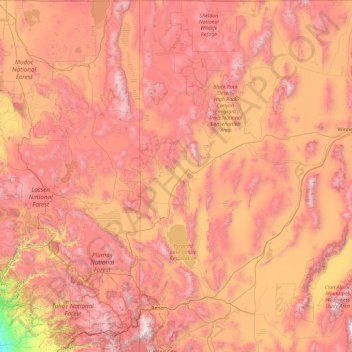
Name: Washoe County topographic map, elevation, terrain.
Location: Washoe County, Nevada, United States of America (39.16554 -120.00573 41.99764 -119.17271)
Average elevation: 1,528 m
Minimum elevation: 30 m
Maximum elevation: 3,161 m
According to the U.S. Census Bureau, the county has a total area of 6,542 square miles (16,940 km2), of which 6,302 square miles (16,320 km2) is land and 240 square miles (620 km2) (3.7%) is water. The highest point in Washoe County is Mount Rose at 10,785 ft (3,287 m), while the most topographically prominent peak is Virginia Peak.