
Afar Region topographic map
Interactive map
Click on the map to display elevation.
About this map
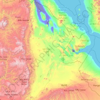
Name: Afar Region topographic map, elevation, terrain.
Location: Afar Region, Ethiopia (8.84303 39.66199 14.54917 42.40418)
Average elevation: 1,081 m
Minimum elevation: -154 m
Maximum elevation: 4,449 m
Other topographic maps
Click on a map to view its topography, its elevation and its terrain.