
Fenton topographic map
Interactive map
Click on the map to display elevation.
About this map
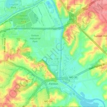
Name: Fenton topographic map, elevation, terrain.
Location: Fenton, Saint Louis County, Missouri, 63029, United States (38.50085 -90.47677 38.55822 -90.40498)
Average elevation: 149 m
Minimum elevation: 114 m
Maximum elevation: 206 m
The topography of the Fenton area is predominantly rolling hills.