
Mudge Island topographic map
Interactive map
Click on the map to display elevation.
About this map
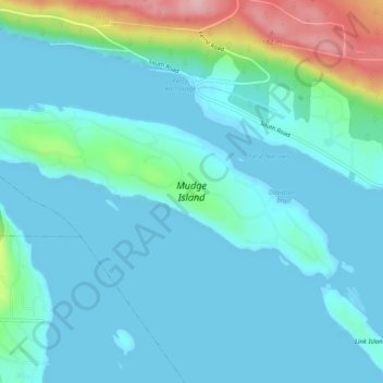
Name: Mudge Island topographic map, elevation, terrain.
Average elevation: 30 m
Minimum elevation: -1 m
Maximum elevation: 173 m
Other topographic maps
Click on a map to view its topography, its elevation and its terrain.
Area B (DeCourcy/Gabriola/Mudge)
Canada > British Columbia > Area B (DeCourcy/Gabriola/Mudge)
Area B (DeCourcy/Gabriola/Mudge), Regional District of Nanaimo, British Columbia, Canada
Average elevation: 10 m