
Guaviare topographic map
Interactive map
Click on the map to display elevation.
About this map
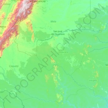
Name: Guaviare topographic map, elevation, terrain.
Location: Guaviare, RAP Amazonía, Colombia (-0.91056 -75.42029 4.28944 -70.22029)
Average elevation: 345 m
Minimum elevation: 83 m
Maximum elevation: 4,079 m
Other topographic maps
Click on a map to view its topography, its elevation and its terrain.