
Macomb Township topographic map
Interactive map
Click on the map to display elevation.
About this map
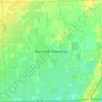
Name: Macomb Township topographic map, elevation, terrain.
Location: Macomb Township, Macomb County, Michigan, United States (42.62753 -82.97691 42.71813 -82.85610)
Average elevation: 186 m
Minimum elevation: 178 m
Maximum elevation: 197 m
Other topographic maps
Click on a map to view its topography, its elevation and its terrain.
Fraser
United States > Michigan > Macomb County
Fraser, Macomb County, Michigan, 48026, United States
Average elevation: 188 m
Washington Charter Township
United States > Michigan > Macomb County
Washington Charter Township, Macomb County, Michigan, 48095, United States
Average elevation: 241 m
Forest Lake
United States > Michigan > Macomb County > Shelby Charter Township
Forest Lake, Shelby Charter Township, Macomb County, Michigan, United States
Average elevation: 202 m
Memphis
United States > Michigan > Macomb County
Memphis, Macomb County, Michigan, United States
Average elevation: 226 m
Clinton Charter Township
United States > Michigan > Macomb County
Clinton Charter Township, Macomb County, Michigan, United States
Average elevation: 184 m
New Baltimore
United States > Michigan > Macomb County
New Baltimore, Macomb County, Michigan, United States
Average elevation: 178 m
Lake Saint Clair
United States > Michigan > Macomb County
Lake Saint Clair, Macomb County, Michigan, United States
Average elevation: 177 m
Saint Clair Shores
United States > Michigan > Macomb County
Saint Clair Shores, Macomb County, Michigan, United States
Average elevation: 179 m
Milton
United States > Michigan > Macomb County > Chesterfield Township
Milton, Chesterfield Township, Macomb County, Michigan, 48051, United States
Average elevation: 187 m
Chesterfield Shores
United States > Michigan > Macomb County > Chesterfield Township
Chesterfield Shores, Chesterfield Township, Macomb County, Michigan, 48047, United States
Average elevation: 178 m
Mount Clemens
United States > Michigan > Macomb County
Mount Clemens, Macomb County, Michigan, 48043, United States
Average elevation: 183 m
Romeo
United States > Michigan > Macomb County > Romeo
Romeo, Macomb County, Michigan, United States
Average elevation: 247 m
Sterling Heights
United States > Michigan > Macomb County
Sterling Heights, Macomb County, Michigan, United States
Average elevation: 191 m
Chesterfield Township
United States > Michigan > Macomb County
Chesterfield Township, Macomb County, Michigan, United States
Average elevation: 184 m
Warren
United States > Michigan > Macomb County
Warren, Macomb County, Michigan, United States
Average elevation: 190 m
Richmond Township
United States > Michigan > Macomb County
Richmond Township, Macomb County, Michigan, 48062, United States
Average elevation: 227 m
Eastpointe
United States > Michigan > Macomb County
Eastpointe, Macomb County, Michigan, 48021, United States
Average elevation: 187 m
Armada Township
United States > Michigan > Macomb County
Armada Township, Macomb County, Michigan, 48005, United States
Average elevation: 233 m
Armada
United States > Michigan > Macomb County > Armada
Armada, Macomb County, Michigan, United States
Average elevation: 228 m
Sterling Heights
United States > Michigan > Macomb County > Sterling Heights > Sterling Heights
Sterling Heights, Macomb County, Michigan, 48313-4615, United States
Average elevation: 205 m
Roseville
United States > Michigan > Macomb County
Roseville, Macomb County, Michigan, 48066, United States
Average elevation: 187 m
Harrison Township
United States > Michigan > Macomb County
Harrison Township, Macomb County, Michigan, United States
Average elevation: 177 m
Shelby Charter Township
United States > Michigan > Macomb County
Shelby Charter Township, Macomb County, Michigan, United States
Average elevation: 205 m