
Le Tampon topographic map
Interactive map
Click on the map to display elevation.
About this map
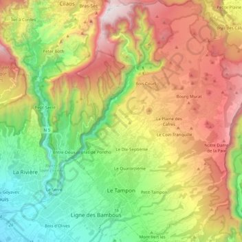
Name: Le Tampon topographic map, elevation, terrain.
Location: Le Tampon, Saint-Pierre, Réunion, France (-21.31661 55.47953 -21.13358 55.66070)
Average elevation: 1,005 m
Minimum elevation: 22 m
Maximum elevation: 2,345 m