
Krasnodar Krai topographic map
Interactive map
Click on the map to display elevation.
About this map
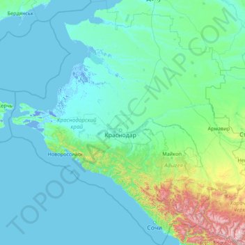
Name: Krasnodar Krai topographic map, elevation, terrain.
Location: Krasnodar Krai, South Federal District, Russia (43.22443 36.53049 47.00302 41.74398)
Average elevation: 202 m
Minimum elevation: -5 m
Maximum elevation: 3,767 m
Other topographic maps
Click on a map to view its topography, its elevation and its terrain.