
Rome topographic map
Interactive map
Click on the map to display elevation.
About this map
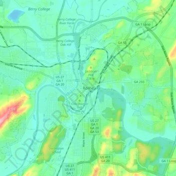
Name: Rome topographic map, elevation, terrain.
Location: Rome, Floyd County, Georgia, 30161, United States of America (34.21704 -85.20467 34.29704 -85.12467)
Average elevation: 200 m
Minimum elevation: 161 m
Maximum elevation: 330 m