
Buryatia topographic map
Interactive map
Click on the map to display elevation.
About this map
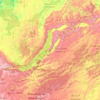
Name: Buryatia topographic map, elevation, terrain.
Location: Buryatia, Far Eastern Federal District, Russia (49.96978 98.62992 57.24988 116.92173)
Average elevation: 923 m
Minimum elevation: 160 m
Maximum elevation: 3,152 m