
Gashland topographic map
Interactive map
Click on the map to display elevation.
About this map
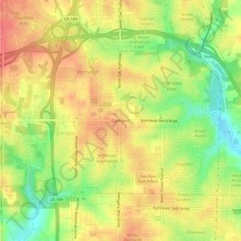
Name: Gashland topographic map, elevation, terrain.
Average elevation: 296 m
Minimum elevation: 258 m
Maximum elevation: 324 m
Other topographic maps
Click on a map to view its topography, its elevation and its terrain.
Nashua
United States > Missouri > Clay County > Kansas City
Nashua, Kansas City, Clay County, Missouri, 64165, United States
Average elevation: 310 m
Barry
United States > Missouri > Clay County > Kansas City > Barry
Barry, Kansas City, Clay County, Missouri, 64188, United States
Average elevation: 301 m