
Parc régional du Lac-Taureau topographic map
Interactive map
Click on the map to display elevation.
About this map
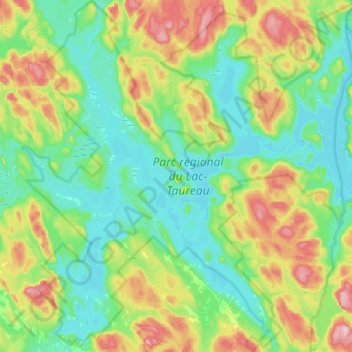
Name: Parc régional du Lac-Taureau topographic map, elevation, terrain.
Average elevation: 415 m
Minimum elevation: 348 m
Maximum elevation: 573 m
Other topographic maps
Click on a map to view its topography, its elevation and its terrain.
Lac Profondeur
Canada > Québec > Matawinie > Saint-Michel-des-Saints
Lac Profondeur, Saint-Michel-des-Saints, Matawinie, Lanaudière, Québec, Canada
Average elevation: 479 m