
Cedar Creek topographic map
Interactive map
Click on the map to display elevation.
About this map
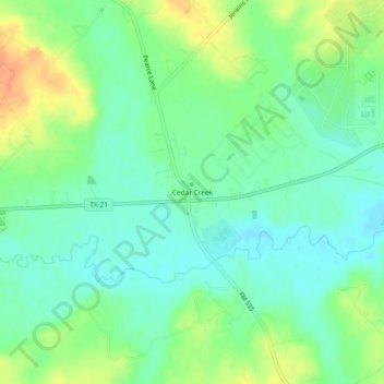
Name: Cedar Creek topographic map, elevation, terrain.
Location: Cedar Creek, Bastrop County, Texas, 78612, United States (30.06716 -97.52083 30.10716 -97.48083)
Average elevation: 137 m
Minimum elevation: 122 m
Maximum elevation: 161 m