
Muntilan topographic map
Interactive map
Click on the map to display elevation.
About this map
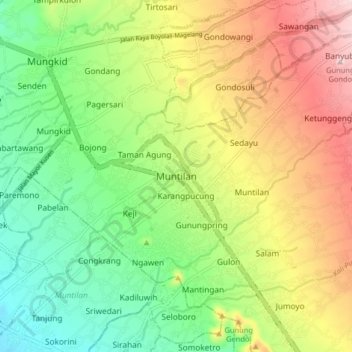
Name: Muntilan topographic map, elevation, terrain.
Location: Muntilan, Magelang, Central Java, 56414, Indonesia (-7.61913 110.24264 -7.53913 110.32264)
Average elevation: 358 m
Minimum elevation: 231 m
Maximum elevation: 535 m