
Laxey topographic map
Interactive map
Click on the map to display elevation.
About this map
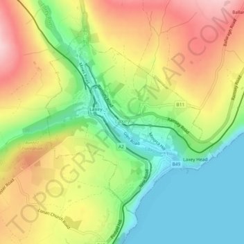
Name: Laxey topographic map, elevation, terrain.
Location: Laxey, Garff, Isle of Man (54.21986 -4.41490 54.24004 -4.38292)
Average elevation: 104 m
Minimum elevation: 0 m
Maximum elevation: 230 m
Other topographic maps
Click on a map to view its topography, its elevation and its terrain.
Agneash
Isle of Man > Garff > Lonan > Agneash
Agneash, Lonan, Garff, Isle of Man
Average elevation: 232 m