
Pingxiang City topographic map
Interactive map
Click on the map to display elevation.
About this map
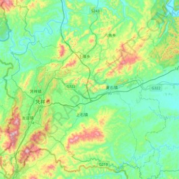
Name: Pingxiang City topographic map, elevation, terrain.
Location: Pingxiang City, Chongzuo City, Guangxi, China (21.96031 106.66958 22.27467 106.99961)
Average elevation: 295 m
Minimum elevation: 110 m
Maximum elevation: 831 m
Other topographic maps
Click on a map to view its topography, its elevation and its terrain.