
Jonesburg topographic map
Interactive map
Click on the map to display elevation.
About this map
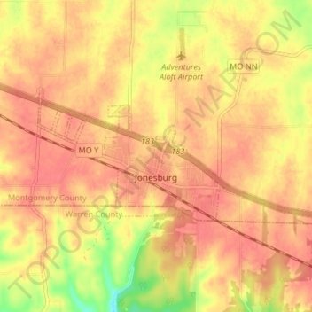
Name: Jonesburg topographic map, elevation, terrain.
Location: Jonesburg, Montgomery County, Missouri, United States (38.84581 -91.33114 38.86785 -91.26495)
Average elevation: 265 m
Minimum elevation: 224 m
Maximum elevation: 281 m
Other topographic maps
Click on a map to view its topography, its elevation and its terrain.
New Florence
United States > Missouri > Montgomery County
New Florence, Montgomery County, Missouri, United States
Average elevation: 259 m
Bluffton
United States > Missouri > Montgomery County
Bluffton, Montgomery County, Missouri, United States
Average elevation: 185 m
Wellsville
United States > Missouri > Montgomery County
Wellsville, Montgomery County, Missouri, 63384, United States
Average elevation: 246 m