
Whiteknights Lake topographic map
Interactive map
Click on the map to display elevation.
About this map
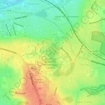
Name: Whiteknights Lake topographic map, elevation, terrain.
Average elevation: 61 m
Minimum elevation: 36 m
Maximum elevation: 85 m
Other topographic maps
Click on a map to view its topography, its elevation and its terrain.
Forest of Arden
United Kingdom > England > Reading
Forest of Arden, Whitley, Reading, England, United Kingdom
Average elevation: 64 m
View Island
United Kingdom > England > Reading
View Island, Reading Hydro, Caversham, Reading, England, United Kingdom
Average elevation: 45 m