
Mat Chau topographic map
Interactive map
Click on the map to display elevation.
About this map
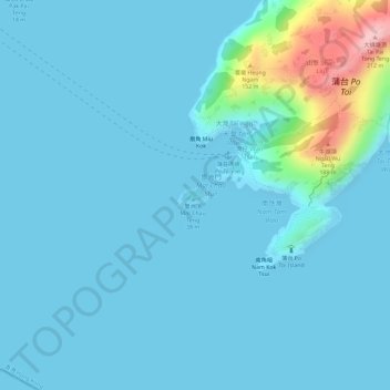
Name: Mat Chau topographic map, elevation, terrain.
Location: Mat Chau, Wan Tsai, Islands District, Hong Kong, PRC (22.15974 114.24909 22.16136 114.25156)
Average elevation: 21 m
Minimum elevation: 0 m
Maximum elevation: 194 m
Other topographic maps
Click on a map to view its topography, its elevation and its terrain.