
Grabouw topographic map
Interactive map
Click on the map to display elevation.
About this map
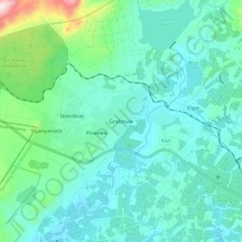
Name: Grabouw topographic map, elevation, terrain.
Average elevation: 358 m
Minimum elevation: 247 m
Maximum elevation: 878 m
Other topographic maps
Click on a map to view its topography, its elevation and its terrain.
Genadendal
South Africa > Western Cape > Overberg District Municipality > Theewaterskloof Local Municipality
Genadendal, Theewaterskloof Local Municipality, Overberg District Municipality, Western Cape, 7234, South Africa
Average elevation: 498 m