
İskenderun topographic map
Interactive map
Click on the map to display elevation.
About this map
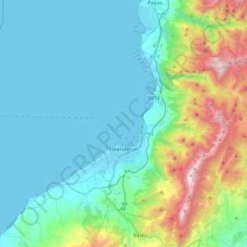
Name: İskenderun topographic map, elevation, terrain.
Location: İskenderun, Hatay, Mediterranean Region, Turkey (36.51351 36.03461 36.72743 36.38346)
Average elevation: 362 m
Minimum elevation: -1 m
Maximum elevation: 1,823 m
Other topographic maps
Click on a map to view its topography, its elevation and its terrain.