
Filfila topographic map
Interactive map
Click on the map to display elevation.
About this map
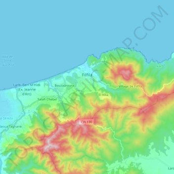
Name: Filfila topographic map, elevation, terrain.
Location: Filfila, Daïra Skikda, Skikda, 21100, Algérie (36.85275 6.98387 36.92118 7.17026)
Average elevation: 134 m
Minimum elevation: -1 m
Maximum elevation: 652 m
Other topographic maps
Click on a map to view its topography, its elevation and its terrain.