
Kashiwa topographic map
Interactive map
Click on the map to display elevation.
About this map
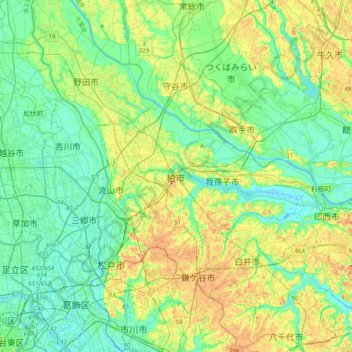
Name: Kashiwa topographic map, elevation, terrain.
Location: Kashiwa, Chiba Prefecture, Kanto, 277-8505, Japan (35.70837 139.81629 36.02837 140.13629)
Average elevation: 14 m
Minimum elevation: -6 m
Maximum elevation: 41 m