
Hiroshima Prefecture topographic map
Interactive map
Click on the map to display elevation.
About this map
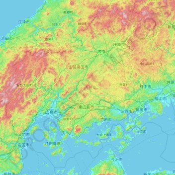
Name: Hiroshima Prefecture topographic map, elevation, terrain.
Location: Hiroshima Prefecture, Japan (34.00762 132.03645 35.10569 133.49736)
Average elevation: 284 m
Minimum elevation: -6 m
Maximum elevation: 1,318 m