
Säntis topographic map
Interactive map
Click on the map to display elevation.
About this map
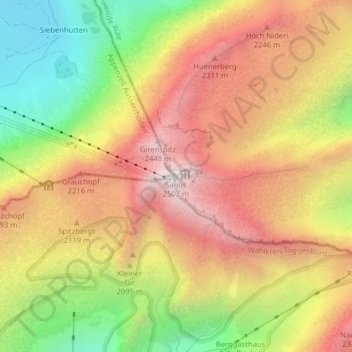
Name: Säntis topographic map, elevation, terrain.
Location: Säntis, Schwende, Appenzell Innerrhoden, 9057, Switzerland (47.24926 9.34347 47.24936 9.34357)
Average elevation: 1,938 m
Minimum elevation: 1,298 m
Maximum elevation: 2,480 m