
Verneuil-sur-Avre topographic map
Interactive map
Click on the map to display elevation.
About this map
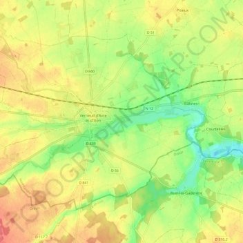
Name: Verneuil-sur-Avre topographic map, elevation, terrain.
Average elevation: 173 m
Minimum elevation: 142 m
Maximum elevation: 200 m
Other topographic maps
Click on a map to view its topography, its elevation and its terrain.
Place de la Madeleine
France > Normandie > Eure > Verneuil d'Avre et d'Iton
Place de la Madeleine, Verneuil-sur-Avre, Verneuil d'Avre et d'Iton, Bernay, Eure, Normandie, France métropolitaine, 27130, France
Average elevation: 172 m
Francheville
France > Normandie > Eure > Verneuil d'Avre et d'Iton
Francheville, Verneuil d'Avre et d'Iton, Bernay, Eure, Normandie, France métropolitaine, 27160, France
Average elevation: 189 m