
Nordhausen topographic map
Interactive map
Click on the map to display elevation.
About this map
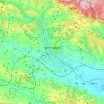
Name: Nordhausen topographic map, elevation, terrain.
Location: Nordhausen, Landkreis Nordhausen, Thuringia, 99734, Germany (51.44048 10.67615 51.55729 10.94796)
Average elevation: 246 m
Minimum elevation: 156 m
Maximum elevation: 561 m