
Gräfenhainichen topographic map
Interactive map
Click on the map to display elevation.
About this map
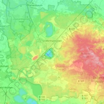
Name: Gräfenhainichen topographic map, elevation, terrain.
Location: Gräfenhainichen, Wittenberg, Saxony-Anhalt, Germany (51.61812 12.32476 51.80049 12.64167)
Average elevation: 96 m
Minimum elevation: 46 m
Maximum elevation: 194 m