
Yucatán topographic map
Interactive map
Click on the map to display elevation.
About this map
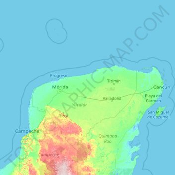
Name: Yucatán topographic map, elevation, terrain.
Location: Yucatán, Mexico (19.55117 -90.40702 21.62509 -87.53315)
Average elevation: 28 m
Minimum elevation: -4 m
Maximum elevation: 239 m
Other topographic maps
Click on a map to view its topography, its elevation and its terrain.