Geolocate

Little Green Island topographic map

Interactive map

Click on the map to display elevation.

About this map

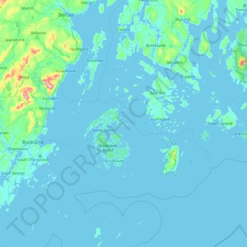
Name: Little Green Island topographic map, elevation, terrain.

Location: Little Green Island, Knox County, Maine, USA (43.82397 -69.12059 44.46397 -68.48059)

Average elevation: 19 m

Minimum elevation: -3 m

Maximum elevation: 409 m

Other topographic maps

Click on a map to view its topography, its elevation and its terrain.

Midway Island

USA > Maine

Midway Island, Kennebec County, Maine, USA

Average elevation: 107 m

The Porcupines

USA > Maine

The Porcupines, Hancock County, Maine, 04660, USA

Average elevation: 24 m

Middle Island

USA > Maine

Middle Island, Washington County, Maine, USA

Average elevation: 58 m

High Island

USA > Maine

High Island, Knox County, Maine, USA

Average elevation: 2 m

The Brothers

USA > Maine

The Brothers, Washington County, Maine, USA

Average elevation: 0 m

Channel Rock

USA > Maine

Channel Rock, Washington County, Maine, USA

Average elevation: 33 m

Crescent Island

USA > Maine

Crescent Island, Oxford County, Maine, USA

Average elevation: 118 m

The Anvil

USA > Maine

The Anvil, Hancock County, Maine, 04613, USA

Average elevation: 14 m

Center Island

USA > Maine

Center Island, Piscataquis County, Maine, USA

Average elevation: 394 m