
Sittard topographic map
Interactive map
Click on the map to display elevation.
About this map
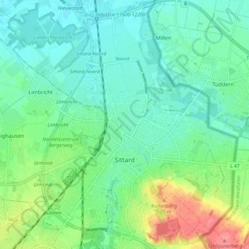
Name: Sittard topographic map, elevation, terrain.
Location: Sittard, Sittard-Geleen, Limburg, Netherlands (50.97801 5.82478 51.03204 5.90552)
Average elevation: 52 m
Minimum elevation: 33 m
Maximum elevation: 101 m
Other topographic maps
Click on a map to view its topography, its elevation and its terrain.