
Davidson County topographic map
Interactive map
Click on the map to display elevation.
About this map
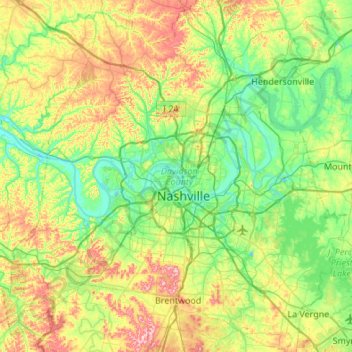
Name: Davidson County topographic map, elevation, terrain.
Location: Davidson County, Tennessee, USA (35.96779 -87.05477 36.40550 -86.51559)
Average elevation: 185 m
Minimum elevation: 114 m
Maximum elevation: 342 m
Other topographic maps
Click on a map to view its topography, its elevation and its terrain.
Great Smoky Mountains National Park
USA > Tennessee > Fort Harry
Great Smoky Mountains National Park, Boulevard Trail, Fort Harry, Sevier County, Tennessee, USA
Average elevation: 765 m