
Amne Machin topographic map
Interactive map
Click on the map to display elevation.
About this map
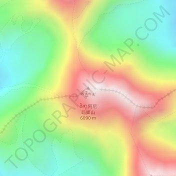
Name: Amne Machin topographic map, elevation, terrain.
Average elevation: 5,499 m
Minimum elevation: 5,042 m
Maximum elevation: 6,082 m
Other topographic maps
Click on a map to view its topography, its elevation and its terrain.
Tongren County
Tongren County, Huangnan Tibetan Autonomous Prefecture, Qinghai, PRC
Average elevation: 3,470 m
Qilian County
Qilian County, Haibei Tibetan Autonomous Prefecture, Qinghai, PRC
Average elevation: 3,252 m