
Iron County topographic map
Interactive map
Click on the map to display elevation.
About this map
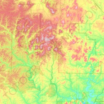
Name: Iron County topographic map, elevation, terrain.
Location: Iron County, Missouri, USA (37.27307 -91.15511 37.74357 -90.53477)
Average elevation: 292 m
Minimum elevation: 125 m
Maximum elevation: 538 m
Other topographic maps
Click on a map to view its topography, its elevation and its terrain.
College Heights
College Heights, Hannibal, Marion County, Missouri, 63401, USA
Average elevation: 193 m
Jordan Valley Park
USA > Missouri > Springfield
Jordan Valley Park, Springfield, Greene County, Missouri, USA
Average elevation: 402 m