
Genoa topographic map
Interactive map
Click on the map to display elevation.
About this map
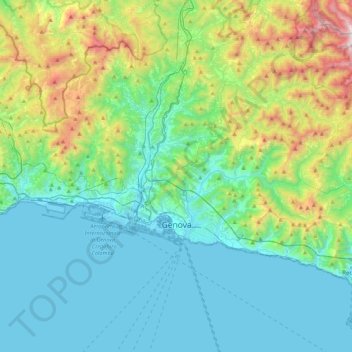
Name: Genoa topographic map, elevation, terrain.
Location: Genoa, Liguria, Italy (44.37847 8.66574 44.51984 9.09558)
Average elevation: 333 m
Minimum elevation: -4 m
Maximum elevation: 1,525 m
Other topographic maps
Click on a map to view its topography, its elevation and its terrain.