
West End topographic map
Interactive map
Click on the map to display elevation.
About this map
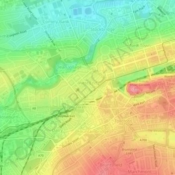
Name: West End topographic map, elevation, terrain.
Average elevation: 59 m
Minimum elevation: 11 m
Maximum elevation: 110 m
Other topographic maps
Click on a map to view its topography, its elevation and its terrain.
Old Town
United Kingdom > Scotland > Edinburgh
Old Town, Edinburgh, City of Edinburgh, Scotland, United Kingdom
Average elevation: 61 m