
Boldre topographic map
Interactive map
Click on the map to display elevation.
About this map
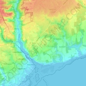
Name: Boldre topographic map, elevation, terrain.
Average elevation: 17 m
Minimum elevation: -6 m
Maximum elevation: 46 m
Other topographic maps
Click on a map to view its topography, its elevation and its terrain.
South Baddesley
United Kingdom > England > Hampshire > New Forest > Norleywood > South Baddesley
South Baddesley, Boldre, Norleywood, New Forest, Hampshire, South East England, England, SO41 5RP, United Kingdom
Average elevation: 13 m